
Montana Search Pilot Clinic 2002
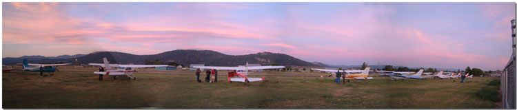
Each September about 30 volunteer pilots from the State of Montana congregate for a grueling weekend of search pilot training. The "students" (many are experienced mountain pilots) devote their time and energy and pay a small fee for the privilege.
 The
course begins on Friday evening with an introduction and ground
school.
The
course begins on Friday evening with an introduction and ground
school.
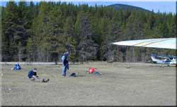
Saturday finds the group divided where some go to flight training and others participate in ELT training and hands-on survival skill training.
For the flight training, six airplanes are used. Three students accompany an instructor and fly to a staging airport. Two students are dropped off to wait their turn to complete the search lesson. Students receive two hours of flight instruction, one hour each from a different instructor. Scheduling generally has the student fly once on Saturday and once on Sunday.
The lesson plan is available as an Adobe pdf file (127 KB) download
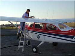
Jeanne MacPherson, Montana Aeronautics Division,
Bureau
Chief Safety and Education, Chief Pilot and Chief Flight Instructor,
fueling a Cessna T-41B.
Jeanne MacPherson

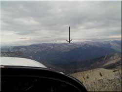
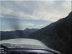
The day before the search pilot clinic was to begin, Jeanne received information that aircraft wreckage was spotted on the west side of the Chinese Wall (east, southeast of Kalispell).
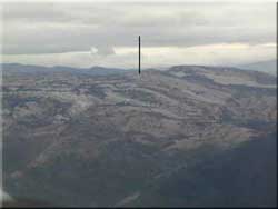
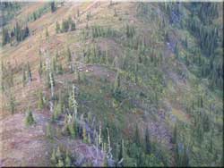
A flight was made to the approximate coordinates of the reported wreckage. The bottom of the line in the photo to the left represents the area of the wreckage.
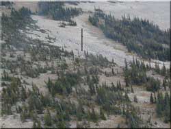
After three passes over the wreckage, using GPS coordinates to pin-point the spot, we were unable to spot the wreckage until sunlight reflecting from its surface disclosed its position.
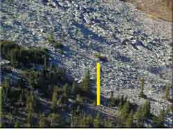
It turned out that the aircraft, at the bottom of the arrow, is a Piper PA-24 that had been wrecked years before. Often an aircraft wreckage is marked with an "x" to indicate it has been found. This airplane did not have any markings and its status was determined by a computer search.
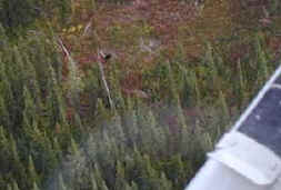 While
maneuvering, a bear is spotted in the trees, and he turned out to be
far easier to see than the aircraft wreckage.
While
maneuvering, a bear is spotted in the trees, and he turned out to be
far easier to see than the aircraft wreckage.
 |
 |
 |
 |
|
Friday evening is the volunteer
pilot's first orientation meeting that covers the rigorous
schedule, training area, grid system, and contour search.
Next is a ground school to learn mountain flying and search
techniques. |
Ferry flights with three
students and an instructor are made to the staging area. Two
of the students are dropped off.
The instructor, with one student, departs on the training flight.
|
During the climb out from the assigned airstrip (Spotted Bear airstrip in this case), the student practices coordination exercises, flight at minimum controllable airspeed, visualizing lift, and a review of the basic premises before the practice of approach and crossing ridges and flying in canyons. |
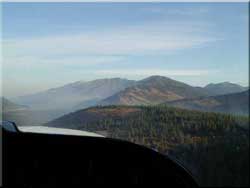
Smoke from small
lightning-caused fires is visible near Hungry Horse
Reservoir during the climb out. Once in the canyons, the
student practices the box canyon turn, contour flying, false
horizon illusion, emergency landings, escaping downdrafts
and turbulence procedures. |
 |
 |
 |
|
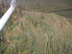
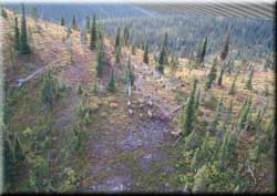
| The contour search is performed with 20 degrees of flaps and 70 knots indicated airspeed while maintaining 500-feet vertical and lateral separation. (Elk near the strut-wing junction and flap-wing junction). | The
drainage (over-the-top) search is also practiced. (Note the
elk on the ridge near center of the picture.) |
After
perfecting the search procedures, the student is exposed to
the techniques for finding and investigating a crash. (Elk
below ridge-line.) |
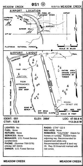
Meadow Creek Airport
 |
 |
 |
 |
|
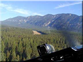
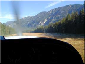
The Meadow Creek airstrip with its 2,830 feet
of available landing area almost seems like an
"international" airport. |
The
approach for landing is to the north on runway 35 at Meadow
Creek. It is recommended that you takeoff
and land on runway 35 because of the trees. If a
go-around is necessary, use caution for
tree obstacles and rising terrain. |
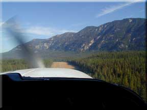
This is a
beautiful setting to escape the rigors of our hectic lives. It is hard to find the "standard" 50-foot obstacle used for flight tests among these trees. They are all 70 feet or higher. |
Meadow Creek Airport |
|
|
|