Survival Vest
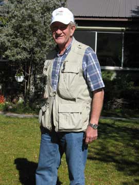
The fishing vest (left) is too short for me or cut improperly so the weight is on the neck instead of the shoulders. June 8, 2007, six days after the accident we drove to Townsend, Montana, and flew home in our Cessna 180. I had refused the morphine-on-demand system at St. Peter's Hospital and used Advil alternated with Tylenol for pain control. The flight was made with the "blessings" of three doctors.
A photography vest (right) is more suitable as my survival vest; better distribution of weight makes it comfortable.
Lost Camera
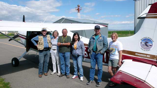
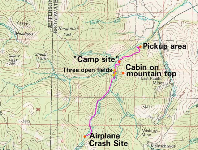
Siew Hwa and I made two trips to Montana on Sept. 7, 2007, and again on Sept. 15, 2007, to search for the lost camera. I had taken photos when we got out of the burning airplane. During the hike from the crash site more photos were taken at the confluence of Badger Creek and the South Fork of Beaver Creek, and again where the South Fork of Beaver Creek joins Beaver Creek in the area of three open meadows located below a cabin on the ridgeline to the southeast.
 Airplane
Crash - Aviat Husky A-1B, N246AM
Airplane
Crash - Aviat Husky A-1B, N246AM
Elk Horn Mountains
N46-24.077, W111-45.464
There was evidence of cattle in the area of the three meadows that would
indicate there would be a trail out. I had walked within 20 yards of the
trail on the north side of Beaver Creek, but because of darkness I did not see it. It would have been an easy
hike out.
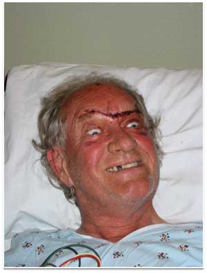
I could not stop the bleeding of the cut on my forehead and I was concerned
about bears. With all the downed timber I figured there would be plenty of
warning if one came around.
I later talked with Cory Bird (the "camp" was on Hahn Ranch property -
Cory's mother was a Hahn) and he said there weren't any bears in the area.
At the September 2008, Montana Search Pilot Clinic, I talked with a fellow
who had hiked in during the retrieval of the aircraft. He said there were
bear-claw marks on the trees around the airplane that were well above his
head.
Glad I didn't know about it at the time.
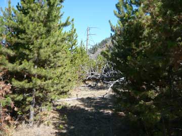
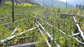
The open area turned out to be a "sucker hole" leading away from the main trail. The new-growth timber was quickly replaced with downed timber, creating a maze.
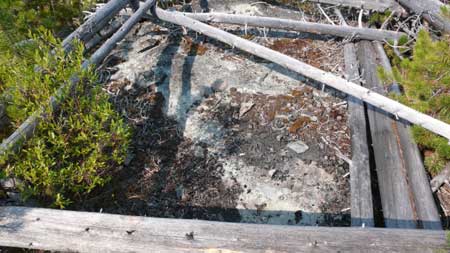
The camera had to be somewhere between the meadows and the pickup point. I though it would most likely be located at the "cabin" or shortly before it where I had fallen backwards off the trees twice before spending the night.
During the first trip, my wife, Siew Hwa and I checked with the Forest Service and Sheriff’s Department to determine the best route to hike to the meadows. We asked if there was any private property where we needed permission to continue and we were assured that if the gate across the road allowed access we could hike there with no problem.
We parked along the road northeast of Weasel Creek and began our trek. Cory Bird was riding his horse up Beaver Creek to check on his cattle, so we joined up. Cory informed us that we were on the Hahn Ranch and said there was no problem with our being there once he found out what we were doing. At first he was concerned with just anyone being on their ranch because of vandalism that had occurred to a water storage tank and some corrals.
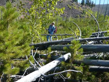
Cory provided "guide service" making it easy to find and follow the Beaver Creek trail. Once we arrived at the first meadow where the trail crosses Beaver Creek, Cory assisted in searching for the "cabin" where I had spent Sunday night on the hike out.
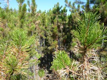
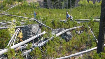
Cory Bird was looking over the beginning of the maze. It
didn't matter what direction you turned, it was all a conglomeration
of downed timber.
Corry searching for the elusive "cabin" where Sparky spent Sunday
night.
Once we arrived at the first meadow it was easy to see where I had gone, but the opening quickly filled with new-growth timber.
We searched to the northeast of the meadows proceeding in the direction where I was picked up. It was tough going and we were unable to locate the "cabin" in the time available. We spent about an hour going back and forth. It shouldn't have been too difficult to spot. I recalled it was an area about 4 feet by 6 feet with a rock that was level with the ground and no vegetation in the "cabin." It was frustrating to be so close. We eventually gave up and hiked back to the Suburban and returned to Jackson, Wyoming.
Second Camera Search
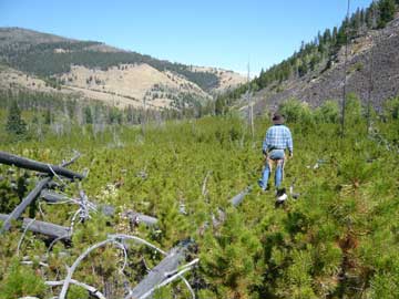
Our second trip to search for the "cabin" was on September 15. Our friend, Bill Gallea, an emergency room doctor at St. Peter's Hospital, and his 11-year-old Lab, Magic, accompanied us.
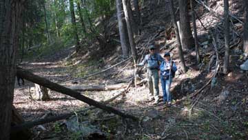
Bill Gallea and Siew Hwa on the trail to the meadows -- Search for the lost camera.
Prior to leaving Jackson for the second hike I searched Google Earth for any open area between the meadows and the pickup point where the Air Force helicopter had extracted me. We established waypoints for the hike. The entrance to the meadows was located at N46º 25' 24.26", W111º 44' 20.12". The National Guard helicopter landed at N46º 25' 37.11", W111º 44' 25.93" at 5,460-feet elevation. The pick-up location was at N46º 25' 37.88", W111º 44' 21.77".
The most likely open spot shown by Google Earth was located at N46º 25' 31.39", W111º 44' 19.71" and 5,460-feet elevation. It turned out the actual location of the "cabin" was at N46º 25.582', W111º 44.357', at 5,487-feet elevation.
We searched the "likely spot" using a Garmin GPSmap 60CSx hand-held receiver, but we were unable to find the "cabin" at the coordinates. We were at the point of giving up and returning to Jackson, when we located the open area that was seen on Google Earth. It was not the cabin but we searched that area to no avail then went a little farther to the northeast. Luckily we found the "cabin" just before crossing to the north side of Beaver Creek to intercept the trail.
 I felt sure that the lost camera would be in the "cabin" since I could only
lay on my right side and the camera was attached to my belt on the right
side. We searched the cabin and couldn't find it. We searched beneath fallen
trees that would have been my most likely path to the "cabin." We were lucky
to have located the "cabin" and laid to rest the feeling that the camera
might be there.
I felt sure that the lost camera would be in the "cabin" since I could only
lay on my right side and the camera was attached to my belt on the right
side. We searched the cabin and couldn't find it. We searched beneath fallen
trees that would have been my most likely path to the "cabin." We were lucky
to have located the "cabin" and laid to rest the feeling that the camera
might be there.
Siew Hwa (above) searching the area
around the "cabin."
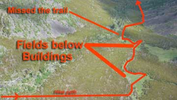
The trail was missed by about 20 yards due to falling darkness (right). Had I
found it, it would only have been about a 2-hour hike in my injured
condition to inhabited buildings and assistance.
You might notice some similarity between "The Shining" and "The Hike."
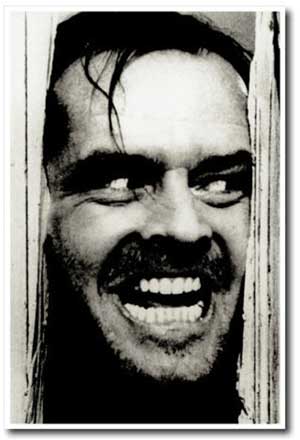
 The
Shining
The
Shining
—Jack Nicholson
The Hike
—Sparky Imeson
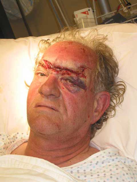 The cut severed a nerve and
my forehead. It remains
The cut severed a nerve and
my forehead. It remains
numb to touch. Siew Hwa used to joke that I was
hard-headed about a
lot of things ...
now she just calls me numb skull.
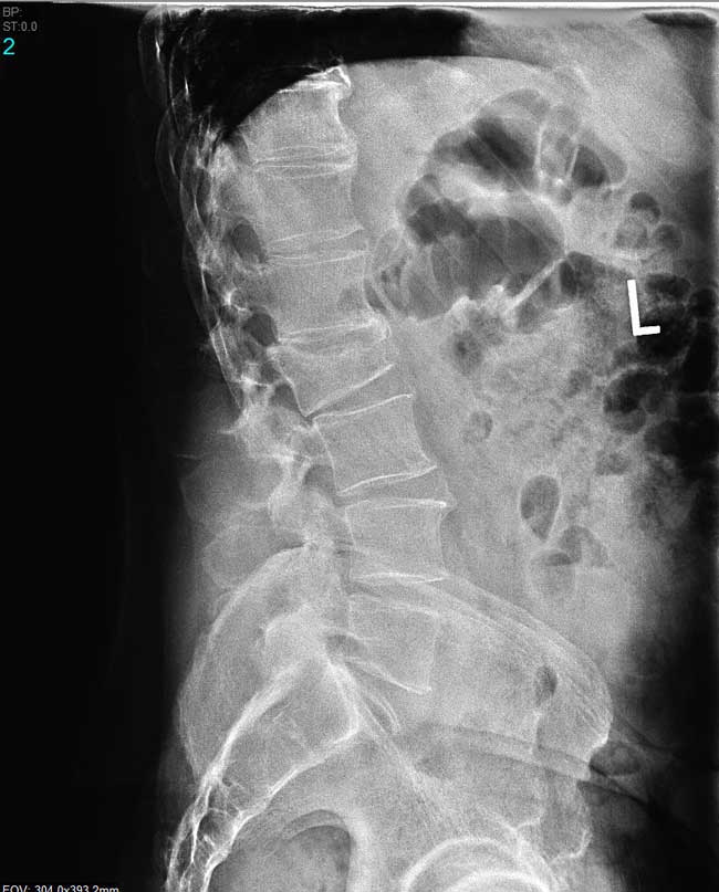
X-ray taken January 29, 2009, showing the damage to L-2. It is all healed (as much as it can be).
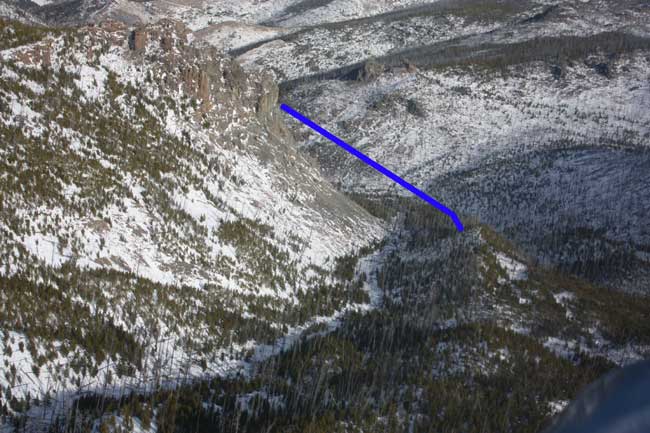
Flight path from rock face to ridge between the South Fork of Beaver Creek and Badger Creek (on right)
|
|
|
|
Home |
Order Form
|
Information |
the Author
| Mountain Flying |
Flying Articles |
Airstrips |
Contact Us |
Updates
|
|
Galen Hanselman |
McCall
Mountain/Canyon Flying |
Peterson's Performance
Plus |
Services |
Return Policy |
Site Map |
Quick Find
|
Page prepared by
Sparky Imeson – Copyright © 1995-2007 Mountain Flying LLC
Mountain Flying, LLC - PO Box 573, Jackson, WY 83001-0573 USA - (307)
733-3516,
Last modified:
02/11/2009