GH-UT Utah Supplemental WAC Chart
 The
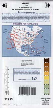
GH-UT Utah Supplemental WAC Chart is a laminated
chart of Utah.
The
GH-UT Utah Supplemental WAC Chart is a laminated
chart of Utah.
What is different about this chart? It covers the backcountry airstrips featured in Fly Utah! Many of the airstrips are not shown on WAC or Sectional Charts; 57 airstrips have never appeared on any aeronautical chart. Also shown are the boundaries of VFR noise sensitive areas, roads, waypoint identifiers and many other features.
Since the chart is laminated you can mark it up with a marker and erase it with a little Tequila. It may come in handy as an emergency ground cloth, picnic table cover, rain poncho or even a waterproof fire starter.
![]()
$19.95
Folded size 5" x 10.25" x 0.15"
Weight 0.1 lbs. (2 oz.)
|
|
|