
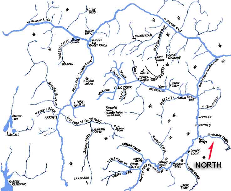
Introduction to Idaho Backcountry Airstrips
 The
Montana Search Pilot Clinic instructors, Aeronautics Division,
attended the McCall Mountain/Canyon Seminars backcountry flying
school on June 15-16, 2001. Friday was spent in ground school;
Saturday was reserved for flying to the magnificent backcountry
airstrips of the Frank Church River of No Return Wilderness area.
The
Montana Search Pilot Clinic instructors, Aeronautics Division,
attended the McCall Mountain/Canyon Seminars backcountry flying
school on June 15-16, 2001. Friday was spent in ground school;
Saturday was reserved for flying to the magnificent backcountry
airstrips of the Frank Church River of No Return Wilderness area.
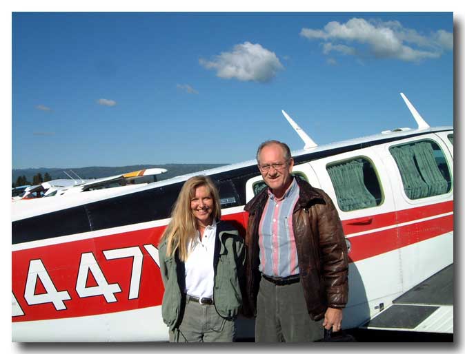
 Photo
left: Lori MacNichol and Sparky Imeson
Photo
left: Lori MacNichol and Sparky Imeson
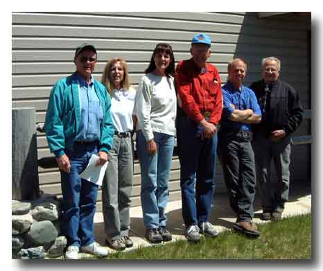
Photo right: Mike Ferguson, Director Montana
Aeronautics; Lori MacNichol;
Jeanne MacPherson, Chief Safety and Education Bureau; Fred Hasskamp;
Art Lazzarenie (McCall Mountain/Canyon Seminars instructor); Stan
Read.
WARNING! The information presented about the Idaho Airstrips is not intended to replace flight instruction from a competent instructor for flying to or landing at any of the airstrips presented. For information concerning instruction into the Idaho backcountry airstrips, call or e-mail Lori MacNichol, 208-634-1344. http://www.mountaincanyonflying.com/
Helpful hints
Lori MacNichol taught the ground school stressing safety. She covered:
- Aircraft performance considerations
- Power settings, airspeeds and configuration
- Steep-stabilized approach
- Turn radius vs. airspeed
- Canyon turns
- Preflight safety items
- Checking out the airstrip
- Gradient
Note Well
First, and foremost, "Keep the big water under your armpit." Accidents occur when pilots turn up the wrong drainage only to find that it is a blind canyon. This shouldn't pose a problem if the pilot keeps the basic tenants of mountain flying in mind, i.e. never fly up a canyon where there isn't room to turn around and don't fly beyond the point of no return. It's easier if you don't turn up a drainage that has no water, or very little water. By keeping the "big water" under you, the main drainage is being followed.
You should be thinking about the surrounding terrain when operating to a backcountry strip. A good way of doing this, Lori explained, is to use tracing paper over the section chart to draw the main river drainages.

This helps maintain situation awareness. For example, Lori was operating from a short-short strip when she noticed an airplane circling overhead. It was not a 'short-field' airplane. She thought to herself, "They aren't going to land here, are they?" The airplane circled and got lower and lower. Lori frantically finished loading her airplane to 'get the heck out of Dodge.' There wasn't room for both airplanes on the strip.
While taxiing, Lori called the other airplane on 122.9 MHz and received a response. The other pilot explained that his LORAN said he was "here," and by golly he was going to land. Lori explained the airstrip he wanted was two miles down the canyon.
The point is, use you compass and navigational skills to stay out of trouble.
Checking Out the Airstrip
Once you arrive at the airstrip, circle overhead and check it out:
-
Surface and condition
Frost = slippery; wet spots = catch a wheel; see where is everyone else is touching down; long grass = got 'cha - Game or livestock present
- Other aircraft operations
- Gradient
- Wind direction and intensity
- Gradient vs. wind
- Surrounding terrain and obstacles
- Planned approach path
- Planned departure path
- Possible emergency landing spots for the approach and departure
- Other items of concern – e.g. wilderness airstrips are designated trailheads. Check for animals, pack strings, people
|
|
|